All published articles of this journal are available on ScienceDirect.

Rapid Seismic Vulnerability and Risk Assessment of Kermanshah Historic Mosques
Abstract
Background:
In this research a rapid vulnerability and risk assessment at a territorial level is performed.
Methods:
The methodology used, initially proposed for ancient masonry churches, is extended and applied to ten historic masonry mosques in Kermanshah city. The method could be considered as preliminary risk assessment approach of historic structures, refers to LV0 method, since the used methodology requires simple qualitative information. It involves the application of three distinct tools; the exposure, the seismic hazard, and the seismic vulnerability.
Results:
The comparisons among the obtained results, by considering also the damages suffered during the last earthquakes and war blasts, validate the methodology proposed, capable of providing a seismic risk scoring at a territorial level also for ancient masonry mosques. As known, through this kind of approach, important information is obtained in order to manage and to mitigate the seismic risk of a certain territorial asset. The results show that all ten mosques has medium earthquake vulnerability condition. Emad e Doleh mosque is the most vulnerable case with vulnerability of 34. Navab mosque is located on the most hazardous place. Furthermore, the seismic vulnerability map and seismic risk indices are presented for all the investigated mosques.
Conclusion:
The obtained results are useful for ranking the priorities and for preliminary defining an interventions plan to be examined in detail with additional quantitative investigations carried out with more refined approaches.
1. INTRODUCTION
Seismic activity threatens cultural heritage in seismic regions. Most of the monumental and historical structures are masonry buildings, which often face with cracks in walls, corners, roofs, and floors during earthquakes. These buildings are particularly vulnerable as they have not been rehabilitated for years. Basically, preserving a cultural heritage in its original characteristics for future generations and finding the most compatible traditional construction methodology with the envi- ronment is important in the rehabilitation plan. Therefore, government managers of these properties is responsible for protecting the outstanding monuments and historic structures. The international efforts led to the development of wide range of manuals in this context [1-7].
When seismic hazard hits a vulnerable area with a high level of exposure, disaster is inevitable. Seismic risk assess- ment which are carried out before an earthquake, means the evaluation of the current seismic risk. Seismic risk assessment can provide the basis for plan of risk mitigation. Hence, governments or development agencies, may categorize low to high risk assets likely to sustain life and economic losses during an earthquake. Besides, still there are many buildings which are not designed to resist earthquake forces according to the modern seismic codes. Nevertheless, most of them have an inherent lateral resistance, due to over-strength factors in design, which may be sufficient to resist low to moderate seismic hazards with an acceptable degree of damage. The results of seismic risk assessment can be used to decide on strengthening intervention and to warn disaster management policies. On the other hand, insurers and reinsurers may use seismic risk assessment results to evaluate the likely losses to humans, buildings, and industry in the case of an earthquake.
To date, various studies and guidelines have been provided so far on vulnerability and risk assessment. From a conceptual point of view the seismic risk assessment methods may be classified in two different groups. The first group consists of rapid methods, also named indirect methods, particularly adapted for a seismic risk assessment at a territorial level. They allow, with fast appraisal methods, of ranking through a final score all the constructions falling within the area considered. On the contrary, the second group is composed by numerical methods that, provides a specific and accurate evaluation by the means numerical simulations with structural models.
An example of the indirect method which uses indicators is the Vulnerability Index Method (VIM), introduced in a study [8] and then was developed, among the others, [9, 10] for masonry buildings. This method uses standard forms to eval- uate the post- earthquake vulnerability level of buildings by considering several in-situ parameters. An extension of the screening tool [9] was presented in a study [11]. They have developed a vulnerability assessment form to consider the structural interaction among adjacent buildings. This new form has been adding to the basic parameters of the original forms which were presented in another study [9], new five parameters are taking into account interaction effects among aggregate structural units at earthquakes. Another example of a simplified scoring method is the one introduced by the Italian Directive [12] and indicated as the Level of Valuation 1 (indicated as “LV1 method,” adapt for evaluations at territorial scale). This method requires only in situ visual inspections, providing a seismic performance in terms of acceptable ground accelera- tion depending on a global vulnerability index. However, this procedure does not allow designing of any structural interven- tion. Other methods, particularly suitable for seismic risk assessment at a territorial scale may be found in a few studies [13-19].
The Italian directive [12] indicates applying numerical methods indicated as Level of Valuation 2 (“LV2 method”) and Level of Valuation 3 (“LV3 method”). These methods have an increasing refinement level, and are based on specific numerical evaluations of structural models regarding portions or entire structures. In particular, as for the LV2 method, it is based on the macro-elements approach, where a macro-element is an architectural portion of an entire structure where the seismic damage arises. This approach stems from systematic survey campaigns conducted in Italy after some recent earth- quakes. The inspections performed highlighted that the struc- tural damages repeatedly occurs in architectural portions, depending on geometrical configuration and construction deta- ils (such as for churches: façade, nave, triumphal arch, dome, bell tower, etc). Among the others, details about this evaluation approach may be found in a few other studies [15, 20-30].
Recently, a new procedure, in continuity with the Italian Directive approach, has been developed and validated for Italian churches [40], and extended also to Chilean adobe churches [41, 42]. This simplified method is useful for a preliminary rapid seismic risk assessment at a territorial scale. In analogy with the Italian Directive [12], it may be proposed within the multi-level approach as Level of Valuation 0 (“LV0” method), since it requires only few qualitative infor- mation about the seismic performance of a given territorial asset, taking also into account the effects produced by previous events. All the data needed may be retrieved by the means of simple systematic surveys and available historical documents.
In this paper, the LV0 method [40], initially proposed for masonry ancient churches is extended and applied to ten historic masonry mosques located in the historical center of Kermanshah city. At first, the case studies are briefly described and detailed with respect to the information available. Then, a rapid seismic risk assessment is performed and commented. The comparison of the obtained results with the damage suffered by the same mosques during the last earthquakes and war blasts validates the extension of the considered method to ancient masonry mosques. In this way, it may be used for quickly ranking the seismic risk of a certain territorial asset characterized by ancient mosques, and for individuating prio- rities and planning additional quantitative investigations with more refined approaches.
2. METHODOLOGY
The methodology that is applied to this research, refers to the LV0 method proposed [40], for providing a rapid risk assessment. The method involves the application of three distinct tools named Tool 1, Tool 2, and Tool 3, each of which assigns a specific score as follows.
● Tool 1: expresses the exposure, E. Exposure is the amount and type of important buildings that are concentrated in the assessed area. The simplified method provides a seismic risk rating without the exposition value of the cultural heritage, Tool 1, by assuming that it is a constant for all the case studies. More details about the E may be found in another study [41].
● Tool 2: provides a seismic hazard score, H. Seismic Hazard, is defined as the probability of a potentially damaging earthquake effect and other threats occurring at a site within a given period of time with the related seismic hazard maps. The threats have been grouped into sporadic events and continuous process, in three families of; natural threats (earthquakes and tsunami; and landslides), physical and chemical threats (eros- ion; thermal and dangers due to atmospheric environment; and air, soil, or water pollution), and socio-organizational and electrochemical threats (fires; explosions; radiation; toxic losses; epidemics or parasites; wars; social hardship manifes- tations; terrorism; vandalism; tourist pressure; population over- load; relative humidity increase; air, marine, or terrestrial acci- dents; forest fires; lack of maintenance; material deterioration; broken pipes; drainage problems).
Among these threats, the most influential threats on cultural heritage are categorized according to the severity of the potential damage to the buildings where a partial score hk,i, depending on damage severity that may occur, is also asso- ciated. Three possible damage levels are considered: No damage (N), Medium damage (M), or Catastrophic (C). The highest H score belongs to earthquake and tsunami threats and the lowest one belongs to air pollution, socio-organizational, and demographic decline.
The resulting seismic hazard score (H) is obtained by summing up each related scores:
 |
(1) |
where the partial score hk,i is reported in Table 1 for each threat considered, is a dimensionless parameter ranging bet- ween 0 and 1.
● Tool 3: provides the seismic vulnerability (V). Seismic vulnerability means the damage that a hazardous event will cause on a specific asset. It is measured as an average percentage of damage or the economic value required to restore the asset to the previous condition. Tool 3 estimates V score with the help of the following 13 parameters (a detailed description may be found in another study [15]):
- (1) Position of the building and foundations: It is defined by indicating the difference in the foundation altitude and ground geology.
- (2) In-plane configuration: It depends on the ratio between the dimensions of minor (a) and major (l) sides of a rectangular building (defined as β1=a/l × 100). In case of plan layouts with different shapes, in addition to the β1 parameter, it is necessary to take into account an additional parameter β2 which is the ratio between the deviation size (b) and the larger dimension (l, i.e. β2 = b/l × 100).
- (3) In-elevation configuration: It depends on a significant surface deference between remaining parts of porticoes and towers or mass deference between each level of the building.
- (4) Distance among walls: It depends on the presence of the support walls which are the walls intersected by transverse ones and are able to prevent the develop- ment of out-of-plane overturning mechanisms.
- (5) Non-structural elements: They are evaluated by the presence of all the non-structural elements, such as fixtures, appendices, projections, etc. the falling of which can lead to the damage to people or things.
- (6) Resistant system type and organization: It is evaluated by the box behavior of the structure and depends on the connections among orthogonal walls regardless of the material characteristics.
- (7) Resistant system quality: Unlike the parameter n. 6, it depends on the material and shape of elements (either stones or solid brick) and quality of mortar.
- (8) Floors: It expresses the type and properties of horizontal floors by rigidity or flexibility of them.
- (9) Roofs: It depends on the roof elements and their connections to walls. Buildings may be divided into thrusts and non-trusting roofs, with and without having edge beams and/or ties.
- (10) Conservation state: It refers to the actual building status and presence and size of the potential cracks.
- (11) Environmental alterations: It may be evaluated by having whole or any of following parameters: accessibility; abandonment; population density; isola- tion; relationship with the geographical context; rela- tionship with the built context; community rela- tionship; disinterest.
- (12) Construction system negative alterations: It may be related to harmful interventions with materials diff- erent from building original ones which leads to high vulnerabilities, and collapse in some cases.
- (13) Fire vulnerability. The affecting parameters are: Presence of flammable materials; roofs or cellars dust accumulation; walls, floors, and doors with low fire resistance; lack of compartment; inadequate exits through doors, corridors, or stairs; faulty electrical systems; faulty fireplaces with soot and grease accu- mulation; low standard in organization of fire drills; fire danger due to smoking or kitchen operations.
Each parameter has been classified into four different vulnerability levels of classes (namely Class A, B, C, and D), where Class A refers to no-very low, B to low-medium, C to high and D to very high vulnerable conditions. The scores, vk,i with the related weights, pk for all the parameters considered are presented in Table 2.
| Threat Parameters | Damage Severity, hk,i | |||
|---|---|---|---|---|
| No Damage (N) | Middle Damage (M) | Catastrophic Damage (C) | ||
| Sporadic Events | Seismic action | 0 | 0.20 | 0.40 |
| Landslide or rock fracture | 0 | 0.15 | 0.25 | |
| Continuous Events | Erosion | 0 | 0.05 | 0.10 |
| Physical stress | 0 | 0.05 | 0.10 | |
| Air pollution | 0 | 0.01 | 0.05 | |
| Socio-organizational threat | 0 | 0.01 | 0.05 | |
| Demographic decline | 0 | 0.01 | 0.05 | |
The global vulnerability score V may be calculated with the following relationship presented in a study [40]:
 |
(2) |
As it is easy to understand by examining the Eq. 2 the higher V score the higher seismic vulnerability of a structure. Moreover, according to the method considered, the global vulnerability score V may result as follows:
- 0 < V ≤ 10.8 corresponding to a low vulnerability condition;
- 10.8 < V ≤ 55.5 corresponding to a medium vulner- ability condition;
- 55.5 < V < 100, corresponding to a high vulnerability condition.
Finally, in accordance with the methodology adopted in this study, the seismic risk is being evaluated through a resulting score R, given in another study [40]:
 |
(3) |
Where H and V are the seismic hazard (Eq. 1) and the seismic vulnerability score (Eq. 2), respectively. The seismic risk score R increases as V and/or H increases. It is defined by modifying the symbolic equation of the seismic risk introduced in another study [43, 44], by adding in the Eq. 3 the unity to the H score for obtaining a resulting score greater than one, unless the exposition value of the monument is considered [40, 41].
3. RESULTS
3.1. Case Studies Description
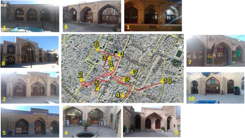
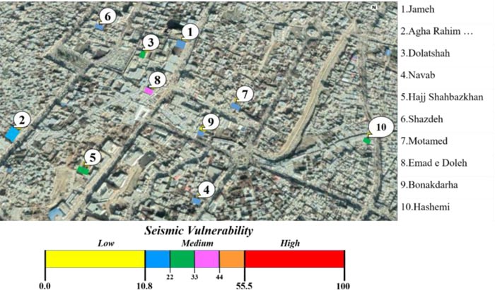
In this study, seismic vulnerability and risk of ten historic mosques are investigated, located in the historical center of Kermanshah city as shown in Fig. (1). These mosques were built in and along with the historic Bazaar of Kermanshah (the red solid line in Fig. (1)) from 1782 to 1896 AD (by the end of Zand era to the end of Qajar era) in following to the transfer of the customs to Kermanshah. Bazaar, itself is a line market which is one of the longest historic Iranian Bazaars. Iranian traditional markets in mountainous cities have been spreads from one town gate to another. Kermanshah Bazaar was linking east and southwest of the city and included in 18 branches and several cultural and social centers like mosques, school, Tekyeh, square, storehouse, caravansary, and tea- house.
| Parameters | Weight pk | Vulnerability vk,i | |||
|---|---|---|---|---|---|
| A | B | C | D | ||
| 1. Position of the building and foundations | 0.75 | 0 | 1.35 | 6.37 | 12.12 |
| 2. In-plane configuration | 0.5 | 0 | 1.35 | 6.37 | 12.12 |
| 3. In-elevation configuration | 1 | 0 | 1.35 | 6.37 | 12.12 |
| 4. Distance among walls | 0.25 | 0 | 1.35 | 6.37 | 12.12 |
| 5. Non-structural elements | 0.25 | 0 | 1.35 | 6.37 | 12.12 |
| 6. Resistant system type and organization | 1.5 | 0 | 1.35 | 6.37 | 12.12 |
| 7. Resistant system quality | 0.25 | 0 | 1.35 | 6.37 | 12.12 |
| 8. Floors | 1 | 0 | 1.35 | 6.37 | 12.12 |
| 9. Roofs | 1 | 0 | 1.35 | 6.37 | 12.12 |
| 10. Conservation state | 1 | 0 | 1.35 | 6.37 | 12.12 |
| 11. Environmental alterations | 0.25 | 0 | 1.35 | 6.37 | 12.12 |
| 12. Construction system negative alterations | 0.25 | 0 | 1.35 | 6.37 | 12.12 |
| 13. Fire vulnerability | 0.25 | 0 | 1.35 | 6.37 | 12.12 |
The studied mosques are numbered according to the year of construction from old to new and listed as follows.
- (1) Jameh mosque. It is one of the oldest mosques in the province. It had forty-five arches and today there are only twenty-five arches left after the war bombing in the late 1970s and early 1980s. The mosque was built in 1782 AD at the end of the Zand dynasty.
- (2) Agha Rahim Al Agha mosque. This solid bricks masonry mosque has been built in 1805 AD. The roof includes 3 domes and 12 cross vaults which stand on 30 brick columns. Most of the columns are surrounded by vertical and horizontal wooden ties up to the springer of the vaults. The structure is located on the trench beside one of the main streets of the city.
- (3) Dolatshah (Abo Torab Al Agha) mosque. This is a masonry building with 4 ancient stone columns from competent rock and 16 brick columns. The mosque was built in 1806 AD. The roof of this structure consists of 10 domes, out of which 4 pointed arches translate their weight to the columns. The work of the Mogharnas altar, and the beautiful chalkboards and wall paintings of the nave (Shabestan) give this mosq- ue a special beauty.
- (4) Navab (Navab Alieh Khanom Kochak) mosque. This mosque was built in 1808 AD almost two years after Dolatshah mosque. It has a regular simple square plan and includes 6 domes and 3 cross vaults that stand on 16 brick columns. At the entrance of the mosque, there are seven stairs below the ground level of the street.
- (5) Hajj Shahbazkhan mosque. This was built in 1820 AD. 12 of the 30 columns of the nave of this mosque are stone columns. There are chambers (Hojreh) on the other three sides of the central courtyard of this mosque and a combination of domes and vaults has given a dreamy look to the roof of this building.
- (6) Shazdeh mosque. It has been built in 1822. AD and includes nave, chambers (Hojreh), central courtyard, and cistern. Its nave has 24 brick columns, 9 domes, and 6 cross vaults. The most special part of this structure is a large cistern with an elevation of approximately 8 m below the ground level, which is built in the north-south direction under the central courtyard. The roof of cistern includes 8 cross vaults, standing on 15 brick columns.
- (7) Motamed (Motamed o Doleh) mosque. Motamed mosque has been built in 1834 AD with the same construction method as the other mosques. Its vestibule is octagonal and reaches the mosque courtyard through a relatively long corridor. The main part of the nave mosque is a rectangle on the south side of the court- yard, with the 18 cross vaults and domes covering the two rows of columns with five columns. The columns are made of bricks, approximately 90 by 90 cm. The middle dome is decorated with glazed brick. On the west side there is a small octagon courtyard with a pond in the middle. Other ancient monuments of this building are stone water ducts around the courtyard.
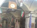
- (8) Emad e Doleh mosque. This mosque is one of the magnificent Qajar mosques in Kermanshah. This beau- tiful mosque was built in 1869 AD by the governor of Kermanshah. The mosque has a central courtyard surrounded by nave (at south side) and chambers (Hojreh) for religious scholars at east and west side, accompanied by a clock tower in the north side of the mosque. After the construction of the mosque, a wooden-door of Emam Ali's shrine from Najaf was installed in the mosque and instead a silver-door was gifted to the shrine. It is today a gateway to the mosque which is a wooden gate from the Safavid era.
- (9) Bonakdarha mosque. It was built in 1880 AD and is located in the Bazaar. At the entrance of the mosque, there are six stairs below the ground level of Bazaar. The walls of the mosque are thick and made of solid brick and mortar. The nave of the mosque has 16 brick columns, which have been covered by domes and cross vaults. The mosque was built in the style of the Qajar mosques and decorated with brick works.
- (10) Hashemi mosque. It was built in 1896 AD near the east gate of Bazaar. It has very simple masonry structure with 16 columns out of which 4 of them are ancient stone columns.
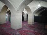
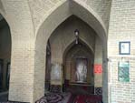
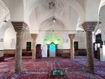
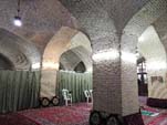
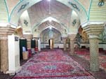
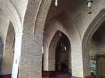
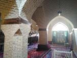
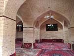
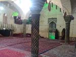
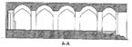
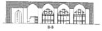
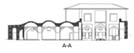
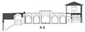
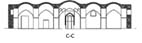
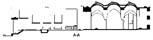
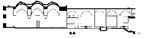
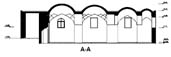
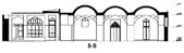
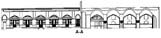
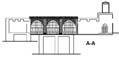
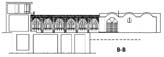
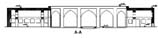
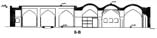
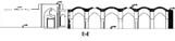
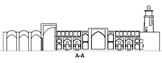
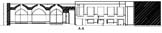
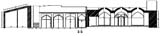
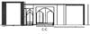
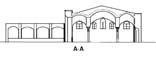
For the sake of completeness, Table 3 presents external and internal view of each investigated mosque. Whereas, geome- trical specifications including in plan, sections, and information about the presence of components like nave, Chamber (Hojr- eh), Central courtyard, and Clock tower, are presented in Table 4. Plans and sections drawings were provided by the Iranian Ministry of Cultural Heritage, Tourism, and Handicrafts (MCTH).
These ten historic mosques were constructed with the Chartaqi (having four cross vaults) method that is an Iranian architectural unit consisting of four barrel vaults and a dome. The mosques’ structures are masonry with horizontal wooden ties in the connection between vault springer and masonry columns and walls, except of the three cases the columns of which are integrated competent stone columns of an ancient palace from the era of the Sassanid Empire of Persia. Their roofs are masonry domes and vaults. These structures were hit by the 1932, 1957, 1958, 1963, 2002, and 2017 earthquakes and 1979 to 1987 impacts of the war blasts. Recently, Iranian Ministry of Cultural Heritage, Tourism, and Handicrafts (MCTH), has been rehabilitating them. The structure of the studied mosques includes nave, chambers (Hojreh), and the central courtyard. There is no high central dome and minarets in any of these historic mosques. The central dome with high ceilings and minarets is characteristic of the mosques of central Iran. The architectural element of mosques in mountainous areas of western Iran due to the cold weather, consists of moderate high nave. In addition, mosques in these areas have minimum connection to the outside by very small windows. The central courtyard of some of them (e.g., Emad e Doleh and Shazdeh mosques) is surrounded by chambers (Hojreh) that are built for religious scholars. These kinds of mosques are entitled as mosque-school. Unlike the mosques of Iran central zone, the main axis of the mosque is not facing the Qiblah (Qibleh faces southwest in Iran). To keep nave space warm, the prayers face the south entrance doors (e. g., Jameh mosque) or lay perpendi- cular to the entrance doors (e. g., Dolatshah, Navab, and Bon- akdarha mosques).
| Name | External View | Internal View |
|---|---|---|
| 1. Jameh |  |
 |
| 2. Agha Rahim Al Agha | 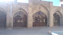 |
 |
| 3. Dolatshah | 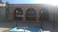 |
 |
| 4. Navab | 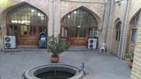 |
 |
| 5. Hajj Shahbazkhan | 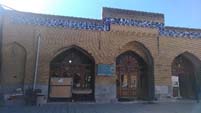 |
 |
| 6. Shazdeh | 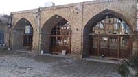 |
 |
| 7. Motamed | 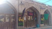 |
 |
| 8. Emad e Doleh | 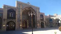 |
 |
| 9. Bonakdarha | 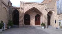 |
 |
| 10. Hashemi | 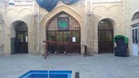 |
 |
| Name | Plan | Section | Nave | Chamber (Hojreh) | Central courtyard | Clock tower |
|---|---|---|---|---|---|---|
| 1. Jameh | 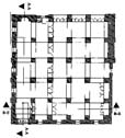 |
 |
√ | √ | √ | × |
 |
||||||
| 2. Agha Rahim Al Agha | 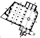 |
 |
√ | × | √ | × |
 |
||||||
 |
||||||
| 3. Dolatshah | 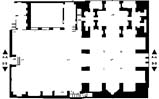 |
 |
√ | × | √ | × |
 |
||||||
| 4. Navab | 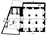 |
 |
√ | × | √ | × |
 |
||||||
| 5. Hajj Shahbazkhan | 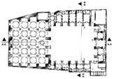 |
 |
√ | √ | √ | × |
 |
||||||
| 6. Shazdeh | 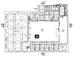 |
 |
√ | √ | √ | × |
 |
||||||
| 7. Motamed | 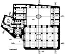 |
 |
√ | √ | √ | × |
 |
||||||
 |
||||||
| 8. Emad e Doleh | 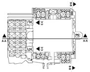 |
 |
√ | √ | √ | √ |
 |
||||||
 |
||||||
| 9. Bonakdarha | 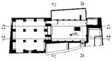 |
 |
√ | × | √ | × |
 |
||||||
 |
||||||
 |
||||||
| 10. Hashemi | 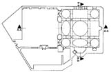 |
 |
√ | × | √ | × |
 |
4. DISCUSSION
4.1. Rapid Seismic Vulnerability and Risk Assessment
4.1.1. Hazards definition (Tool 2)
For seismic vulnerability and hazard assessment of historic mosques, survey forms were filled out. The analysis of the site survey, using seismic hazard map of Kermanshah microzo- nation [45], and the employed procedure lead to provide seismic hazard indicators, H (introduced in the Table 1). The hazard evaluation results and total H score for each mosque are presented in Table 5.
Despite their probable bedrock acceleration similarities due to similar distance from earthquake source and active faults, these mosques differ in site specifications. While some of them are located on flat terrain (e.g., Bonakdarha and Hashemi mosques), others are located on the slight slope (e.g., Jameh mosque) or above the trench (e.g., Agha Rahim Al Agha, Dolatshah, Navab, and Hajj Shahbazkhan mosques) that may increase the score for the landslide threat. In addition to topography, changes in soil degree of saturation due to soil characterization or water flow affect the foundation of some of these mosques (e.g., Navab mosque), which may increase the erosion threat score. Note that, as results from the scoring performed Navab mosque (because of water flow beneath its foundation due to an old water channel) has the largest H score and Bonakdarha and Hashemi mosques have the least H score.
4.1.2. Vulnerability (Tool 3)
Tool 3 is necessary to find out seismic vulnerability score V of each considered mosque. For implementing Tool 3and finding introduced 13 parameters, collecting data of structural properties for all of ten mosques are necessary. Table 6 summarizes the evaluation of the vulnerability level (VL) assigned to each parameter and the resulting global vulnera- bility score V (Eq. 1) for all the investigated case study.
| Threat Parameters | Mosques | ||||||||||
|---|---|---|---|---|---|---|---|---|---|---|---|
| 1 | 2 | 3 | 4 | 5 | 6 | 7 | 8 | 9 | 10 | ||
| Sporadic Events | Earthquake and tsunami threat | M | M | M | M | M | M | M | M | M | M |
| Landslides or rock fracture | M | C | C | C | C | M | M | M | N | N | |
| Continuous Events | Erosion threat | M | M | M | C | M | M | M | M | M | M |
| Physical stress of threat | C | C | C | C | C | C | C | C | C | C | |
| Air pollution | M | M | M | M | M | M | M | M | M | M | |
| Socio-organizational threat | M | M | M | M | M | M | M | M | M | M | |
| Demographic decline | C | C | C | C | C | C | C | C | C | C | |
| Total Score (H) | 0.57 | 0.67 | 0.67 | 0.72 | 0.67 | 0.57 | 0.57 | 0.57 | 0.42 | 0.42 | |
| Parameters | Vulnerability Class | |||
|---|---|---|---|---|
| A | B | C | D | |
| 1. Position of the building and foundations | - | 9 | 1 | - |
| 2. In-plane configuration | 3 | 6 | 1 | - |
| 3. In-elevation configuration | 9 | - | 1 | - |
| 4. Distance among walls | - | 9 | 1 | - |
| 5. Non-structural elements | - | 7 | 3 | - |
| 6. Resistant system type and organization | - | 7 | 3 | - |
| 7. Resistant system quality | - | 10 | - | - |
| 8. Floors | 9 | - | 1 | - |
| 9. Roofs | - | - | 10 | - |
| 10. Conservation state | - | 9 | 1 | - |
| 11. Environmental alterations | - | 10 | - | - |
| 12. Construction system negative alterations | - | 10 | - | - |
| 13. Fire vulnerability | - | - | 10 | - |
The main peculiarities of the investigated mosques may be summarized as follows.
- (1) Position of the building and foundations: All the mosques are placed on rocky terrain with a ground slope of 10–30% (Class B), except Jameh mosque which is located on a ground slope of 30–50% (Class C).
- (2) In-plane configuration: The mosques of Jameh, Navab, and Hashemi have almost square plan with β1 ≥ 80 and β2 ≤ 10 (Class A), while most of the other cases (except one) have rectangular with 60 ≤ β1< 80 and 10 < β2≤ 20 (Class B). The exception is Emad e Doleh which falls in Class C, because of the ratio between minor and major dimensions.
- (3) In-elevation configuration: All the case studies have uniform mass distribution over the whole height (Class A), except Emad e Doleh which has the worst situation owing to the reduction of the floor area resulting more than 20% (Class C).
- (4) Distance among walls: Again all the investigated structures except Emad e Doleh with have three of the defined conditions (slenderness (height/thickness) <8; the distance between the wall bracing axes must be <6 times the wall thickness; the wall relative verticality must not be >10% of its height) falling in Class B, Emd e Doleh mosque falls in Class C.
- (5) Non-structural elements: Among all of the investigated mosques, three cases (Navab, Hajj Shahbazkhan, and Emad e Doleh) have external fixtures poorly bounded to the walls and with small false ceilings not well-connected, classified as Class C. The others fall in Class B.
- (6) Resistant system type and organization: All case studies, except three cases, have solid brick masonry columns that are well-connected to roof (Class B). The exceptions (Dolatshah, Hajj Shahbazkhan, and Hashe- mi mosques) have stone columns that do not have adequate connections between walls and roofs (Class C).
- (7) Resistant system quality: The main material of all the investigated structures are 20 cm ×10 cm × 5 cm solid bricks having a medium quality mortar (Class B).
- (8) Floors: Among all cases only the Emad e Doleh mosques have staggered deformable floor which have good connections among walls (Class C). The others floor of the others mosques may be classified in Class A.
- (9) Roofs: All the investigated mosques have non-thrusting roofs, made of the original building materials or materials compatible to the original ones in terms of strength and stiffness (solid brick masonry domes and vaults) and without edge beams and/or metal tie rods (with wooden ties) (Class C).
- (10) Conservation state: Site surveying has shown that all mosques except Navab mosque have no diffused cracks (Class B), and Navab mosque has medium-size cracks (width of the lesion: 2-3 mm) probably due to erosion induced by water flow beneath the foundation (Class C).
- (11) Environmental alterations: All the cases have almost three of the environmental alterations (Class B) which were introduced before in Tool 3 explanations.
- (12) Construction system negative alterations: Previous modifications to the building system by nonreversible interventions made of materials compa- tible to the original ones in terms of strength and stiffness, present a good conservation status in all of the mosques (Class B).
- (13) Fire vulnerability: All of the investigated mosques are low fire resistance due to the presence of flammable materials (i.e., fabric curtains); covered floors with carpets, and wooden doors and ties with low fire resistance; lack of compartments; inadequate exits through doors; faulty electrical systems; fire danger due to kitchen operations (Class C).
The most vulnerable mosque is Emad e Doleh, which has been constructed with elevation irregularities in two floors in nave and chamber parts and a clock tower.
Table 7 presents the recurrence of the vulnerability classes for each parameter considered within the investigated mosques sample. One may note that in the cases analyzed there is a prevailing vulnerability class for each of the different vulnerability parameters. This is due to the fact that many mosques are quite similar because they were constructed and rehabilitated with same materials, forms, and construction technology in a close period of time. In no case the vulne- rability Class D is assigned in the sample considered. Moreover, the Emad e Doleh mosque (case n. 8), due to different numbers of floors, presents a recurrent vulnerable situation.
As for the obtained global vulnerability scores V, the resulting scores range from 15.16 to 34, with an average value of 20.47. These thresholds correspond, accordingly to the method adopted, to a medium vulnerability classification for all the mosques analyzed in this study.
4.2. Seismic Risk Assessment and Comparison of the Results
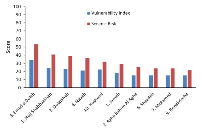
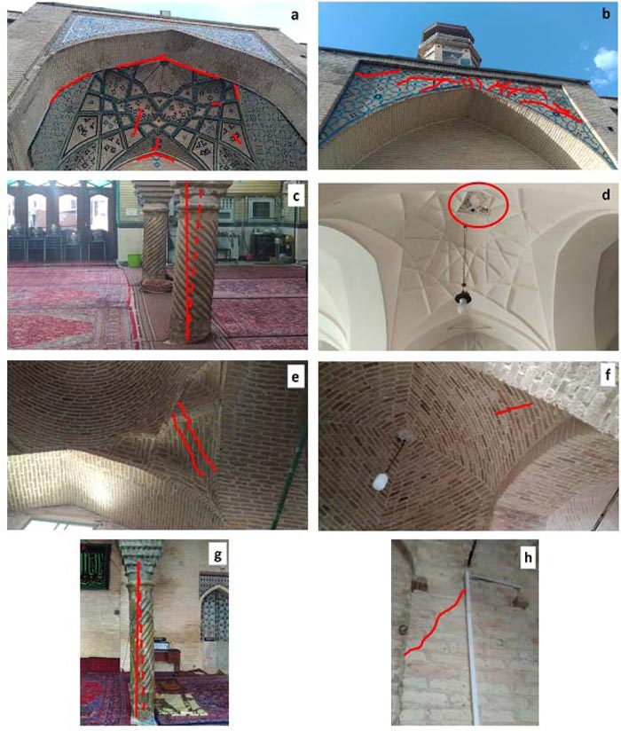
The seismic risk assessment R at a territorial level has been evaluated in this study according to Eq. (3), starting from the hazard and vulnerability scores previously derived. The resul- ting scores of R, are presented in Table 8. In order to clearly illustrate these results, Fig. (2) presents a seismic vulnerability map of the investigated mosques. They have a seismic risk score R varying from 21.53 to 53.28, falling within a medium vulnerability score (from 15.16 to 34). Fig. (3) shows a comparison between vulnerability and seismic risk score for each mosque in the form of a histogram. In this graph the results are sorted in the descending order with respect to the seismic risk score R. As it is clear to note, in the cases analyzed the seismic risk decreases as the related vulnerability decr- eases. These results are in good agreement with the damages trend of the historical earthquakes hits and the war blasts, which had happened in a short distance as well as recent Sarpol e zahab earthquake in 2017 (Mw=7.3) [46] with an epicentral distance of about 130 km, with an intensity grade of V-VI according to EMS-98 European Macroseismic Scale [47]. Precisely, Emad e Doleh mosque (n. 8) shows cracks on façade half dome located on the west side (Fig. 4a) and the clock tower on the north side leaned a little toward east side while the punching cracks occurred on the top of its abutment structure (Fig. 4b); one of the stone columns of Hajj Shahbazkhan mosque (n. 5) had inclination without presenting tangible cracks on its corresponding vaults (Fig. 4c); Dolatshah mosque (mosque n. 3) suffered cracks in central dome (Fig. 4d); Navab mosque (n. 4) had cracks in the rib (Fig. 4e); Hashemi (n. 10) mosque also shows cracks in the rib (Fig. 4f), inclination on the stone columns (Fig.4g), and cracks in the wall (Fig. 4h); Jameh (n. 1), Agha Rahim Al Agha (n. 2), Shazdeh (n. 6), Motamed (n. 7), and Bonakdarha (n. 9) mosques did not suffer any damages. This good agreement obtained between the observed damages (intensity and distribution) and the seismic risk ranking validates the extension of the simplified method applied in this study also to the case of the ancient masonry mosques. Therefore, it may be extended to different areas for assessing the seismic risk and for listing the priorities through the resulting risk score. In this way, an in-depth evaluation with refined models may be performed in order to design effective interventions for mitigating the current seismic risk.
| Mosques | Hazard, H | Vulnerability, V | Seismic Risk, R | |
|---|---|---|---|---|
| 1.Jameh | 0.57 | 18.52 | 29.08 | |
| 2.Agha Rahim Al Agha | 0.67 | 15.16 | 25.32 | |
| 3.Dolatshah | 0.67 | 23.23 | 38.79 | |
| 4.Navab | 0.72 | 21.21 | 36.49 | |
| 5.Hajj Shahbazkhan | 0.67 | 24.58 | 41.04 | |
| 6.Shazdeh | 0.57 | 15.16 | 23.80 | |
| 7.Motamed | 0.57 | 15.16 | 23.80 | |
| 8.Emad e Doleh | 0.57 | 34.00 | 53.38 | |
| 9.Bonakdarha | 0.42 | 15.16 | 21.53 | |
| 10.Hashemi | 0.42 | 22.56 | 32.03 | |
CONCLUSION
In this research, the results of a rapid seismic risk assessment at a territorial scale of ten mosques belonging to Kermanshah historic center have been illustrated. The seismic risk assessment has been performed by extending to the mosques’ typology the simplified method (LV0 method) prop- osed in other studies [40, 41], initially developed for ancient masonry Italian churches. This method combines the hazard and vulnerability scores in order to provide a seismic risk score which is an important parameter for ranking the priorities and for further insurance validation. In addition, this method is also an efficient method to quickly perform and compare seismic risk evaluations at a territorial scale in different geographical areas.
The investigated case studies are ten historic mosques with solid brick masonry structures, built from 1782 to 1896 AD by Chartaqi architectural construction method. As regards the seismic hazard, H, the most hazardous case results Navab mosque, due to an existing water channel make erosion on its foundation. Whereas, as far as the seismic vulnerability V is concerned, the obtained results show that all the investigated mosques have a medium vulnerability index. Among the cases analyzed, the Emad e Doleh mosque, with different numbers of floors and in-elevation configuration irregularities, result in the most vulnerable mosque, with also the highest seismic risk score.
The applied rapid seismic evaluation method provides a ranking among the mosques investigated. The predicted results obtained are in good agreement with the damage suffered by the same mosques during the last earthquakes and war blasts, validating the extension of the simplified method applied in this study also to the case of the ancient masonry mosques. Starting from these results, and by taking also into account the information reported within the inspection forms of the mosques, it will be possible to individuate any repetitive structural damage, so that a macro-element approach also for mosque may be proposed. To this scope, it will be necessary to individuate the construction parts composing the structural organism and the construction details that are determinant in damage occurrence due to seismic action.
AUTHORS' CONTRIBUTIONS
All authors listed have made a substantial, direct and intellectual contribution to the work, and approved it for publication.
CONSENT FOR PUBLICATION
Not applicable.
AVAILABILITY OF DATA AND MATERIALS
All datasets generated or analyzed for this study are included in the manuscript.
FUNDING
None.
CONFLICT OF INTEREST
The authors declare no conflict of interest, financial or otherwise.
ACKNOWLEDGEMENTS
The authors wish to thank Kermanshah Administration of Iranian Ministry of Cultural Heritage, Tourism, and Handi- crafts (MCTH) for providing architectural plans and sections for the historic mosques.

